
Remember When Temple Wasn’t a Post-Apocalyptic Wasteland?
Long ago, in an age undreamed of, travelers could cross I-35 in Temple with ease. Bridges and lights ensured safe, fair passage, and entrance and exit ramps were plentiful. It was a marvelous time to be alive.
Then, the dark days came. The yellow beasts, driven by their cruel master, TxDOT, brought the bridges to ruin, and though they vowed to rebuild, ages passed and travelers dreaded leaving their homes.
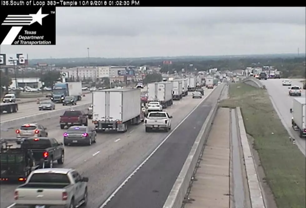
Okay, I'm being melodramatic, but it's become increasingly difficult to remember a time when getting around Temple wasn't a waking nightmare due to the seemingly endless I-35 construction.

After a particularly frustrating drive in the summer heat, I was longing for the good ol' days. I wanted to visit a simpler time when crossing from the west side of 35 to the east was a breeze.
That's when I turned to Google Maps.
Thanks to archived Street View images, we can travel back in time and visit Temple before it was a rubble heap.
Let's go on a journey, shall we?
This is the intersection of 31st and Adams in January of 2008. Look at those gas prices! Still, I'd be willing to pay a little more for gas if I could actually freakin' get around.

Oh, you want to get to N. General Bruce? Headed to Starbucks or Whataburger? Why, come on through! It's December of 2007, and you don't have to navigate between giant concrete slabs and chunks of the torn-up road. You can also go straight to get to the southbound 35 entrance ramp or Airport Rd. Easy peasy.

It's May of 2011, and the way's still clear! Sail on through, buddy.

Yep. May 2011 was a nice time to drive around here. (Though that summer would end up being one of the most dry, hot, and miserable I can remember.)

It's December of 2007 and hey, check it out! Traffic lights! Remember those?

It's October of 2015, and dark clouds shaped like construction barrels loom on the horizon.

It's August of 2013, and this is a functioning intersection. Imagine that.

It's May, 2011, I'm headed north on 57th toward I-35, and *gasp* I have options!

Some day all the rubble will be cleared and we'll have beautiful new bridges. I'm sure of it.
I'm also sure we'll have flying cars by then, but at least we'll have those bridges available for emergency landings.
More From KTEM-AM